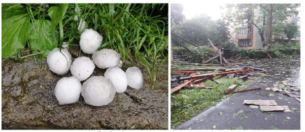
The main purpose of the study is to analyze the conditions and impact of severe weather phenomena in Sălaj and Maramureș counties. A supercell storm that crossed a significant part of the mentioned area in the 28th May 2019’s afternoon, also affecting Zalău and Baia Mare was chosen as a case study through its impact and severe threats that occurred, leaving many damages over the area. The analyzed phenomena are convective, generated by Cumulonimbus clouds with a considerable vertical extent. Synoptic and mesoscale conditions were determined using the specific methods of investigation (charts of sea level pressure, geopotential height, temperature and humidity, atmospheric soundings, different stability indices, vertical wind shear, infrared and visible satellite images and radar images of convective storms). The main findings are: synoptic conditions were determined by low values of atmospheric pressure at the surface and by the atmospheric depressions, while in the middle troposphere, an atmospheric trough was present; mesoscale conditions presented: elevated values of Convective Available Potential Energy, negative values of Lifted Index, and strong wind shear in the 0-3 km layer.
Category: Uncategorized

Vegetation fires in Romania: an overview
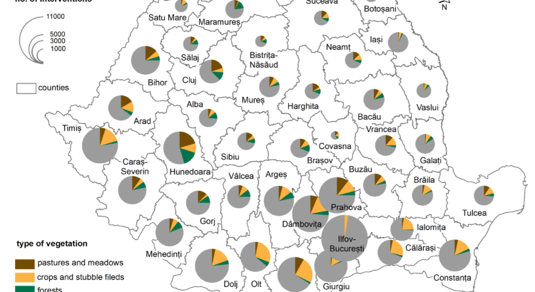
ABSTRACT. – The main purpose of the present paper is to explore the current state of knowledge upon the occurrence and impacts of vegetation fires in Romania and to make a brief report on the sources of data concerning such events, in order to pave the road for further, more detailed studies upon the occurrence of vegetation fires in Romania. Using satellite images-based applications available at EFFIS we could observe that Romania is indeed impacted by many fire events every year. In addition, we worked with a large database provided by the General Inspectorate for Emergency Situations, that includes over 150,000 entries, regarding interventions of fire brigades on vegetation fires in Romania. Among other aspects, these data showed that the main regions for such interventions were the southern and western parts of the country and that the monthly occurrence of such events corresponds to timeframes typical for clearing agricultural lands.
Keywords: vegetation fire, land use, agriculture, impact, Romania.

Assessing soil erosion caused by raindrops utilizing the index of erosion through precipitation (R-factor).
PAULA CODREA, I.H., HOLOBÂCĂ![]() , I.A., IRIMUȘ
, I.A., IRIMUȘ![]() , L. B-BÁLINT
, L. B-BÁLINT
ABSTRACT. Soil erosion caused by raindrops is a topic that arouses the interest of researchers at the international level. The negative impact that this meteorological phenomenon has on the edaphic component determines a limited development of the zone or area on which the entire research process takes place. In order to arrive at an analysis consistent with the reality on the ground, many researchers have used an essential indicator, namely, the R-Factor. It highlights the action of the kinetic energy produced by precipitation over a period of time. The purpose of our research is to reveal the degree of soil erosion following raindrops, with the Someșan Plateau situated in North-West Romania as a study area. The spatio-temporal analysis consisted in the processing of the ESDAC (European Soil Data Centre) databases that were outlined following the application of the R-factor indicator, on which we applied GIS techniques, in order to finally obtain cartographic material that reveals on the basis of several analysis indices, the degree of soil erosion in a time interval (1970-2018). The notable results that we obtained after processing the data, outline the fact that during the analyzed period a low amount of precipitation is recorded, an aspect that creates a low degree of erosion. Regarding the probability of producing erosion determined by this meteorological phenomenon, the values obtained are reduced far below the normal values of the analyzed indicators, highlighting that the probability of producing a high-risk erosion in the near future is zero.The results of our research, including the entire cartographic material, will be able to be used by the competent authorities (the town hall of Bălan commune, the county councilas) as a basis for spatial development projects
Key words: soil erosion, degradation, rain drops, R-factor, indicators, Someșan Plateau, Romania
